On November 8, the state gauge at Lake Almanor read 4,483.28 feet. On October 1 it had read 4,485.65 feet. In the first week of November it fell a few hundredths of a foot every day: 4,483.72 on November 1, 4,483.52 on November 4, 4,483.28 on November 8. If you tour an East Shore or Hamilton Branch lakefront home this month, you will walk down to a waterline that sits lower than it did in summer. The ground you cross on the way there may not come with the house.
Around Lake Almanor, a lakefront purchase has two parts. One is the lot on your deed. The other is the shoreline between that lot and the water, which belongs to PG&E. Any dock or buoy on it exists under an agreement with the utility. November is a good month to see how those two parts fit together.
The deed stops at a contour line
PG&E's Lake Almanor land management policy puts the utility's line of ownership at the 4,500-foot elevation contour, measured on PG&E's own datum. That line sits 6 feet higher in elevation than the lake's operating high-water line of 4,494 feet. So a summer lake at high water still doesn't reach the edge of PG&E's land. A band of utility property runs between them.
The policy also says how wide that band can be. Depending on terrain, the 4,500-foot line "may be very close to, or very far from, the high water line," and the policy tells adjacent property owners to get professional survey work before doing anything that could fall below it. On a gentle slope, a few feet of elevation can cover a long stretch of ground. On a steep bank, the same few feet may be a short walk.
That matters on a showing because nothing on the ground marks the contour. A lawn, a path or an old set of steps toward the water says nothing about where the lot ends. The policy is direct about what can't go on PG&E land. It doesn't permit decks, patios, fencing, retaining walls, landscaping, irrigation or utility installations there, and it doesn't permit private individual boat ramps, log booms or boat launching devices. Excavation, grading, dredging, removing stumps and rocks, and trimming vegetation below the line all need a PG&E permit first. Motorized wheeled vehicles are barred below 4,500 feet, with exceptions for places such as public and private boat ramps, resort operations and work PG&E has approved in writing. Septic systems aren't allowed on PG&E land at all.
The dock is an agreement with the utility
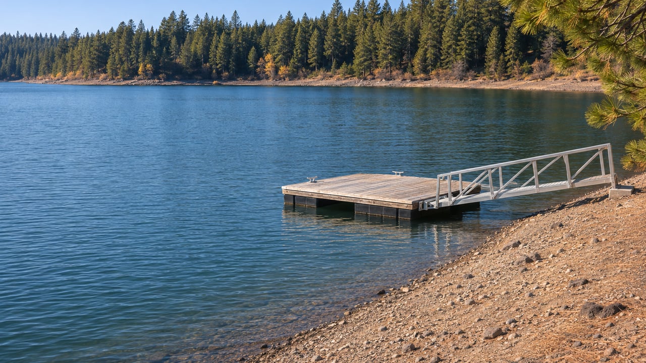
A dock in the photos looks like part of the house. Under PG&E's policy, it is personal property that sits on PG&E land because of an agreement. Only owners of parcels adjacent and contiguous to the shoreline can qualify, and PG&E decides each case at its discretion. These are the terms of a PG&E Dock and Buoy agreement as the policy states them:
- One dock no larger than 300 square feet and/or up to two buoys per private noncommercial lot, with the dock design approved by PG&E before installation.
- Swim docks, water trampolines and aqua jumps count as dock facilities, so they can be permitted in place of a boat dock but not in addition to one.
- PG&E may require communal docks and may restrict facilities in coves, congested areas and environmentally sensitive areas.
- A dock may not extend more than 200 feet from the waterline or more than one third of the way across a cove or inlet, and it should sit at least 40 feet from neighboring facilities where practicable.
- Every dock and buoy under agreement gets an identity tag. Any installation without one in a visible spot is in trespass and subject to removal.
- Docks or buoys that don't meet the standards must be upgraded, repaired or removed. Major repairs have to be done on dry ground above the 4,494-foot contour.
- Exposed foam flotation and corrodible barrels or drums don't meet the standards.
The transfer provision matters most for a buyer. PG&E records these agreements at the Plumas County Recorder's Office only when it chooses to. When it does, it "may require that Assignments of interest be made and recorded with successive owners of that particular lot." The policy doesn't say whether an existing dock agreement passes to a buyer when the house sells, so the agreement's status is a question to put to PG&E during the transaction.
PG&E dates this policy to 1992, revised March 2011, and still links it from its current Land Use and Sales page. PG&E's general land-use request page says proposed uses may involve nonrefundable administrative fees and rent. The current specifics of any one agreement are PG&E's to confirm.
Why a November showing tells you more
Lake Almanor is a working reservoir, and its levels follow a yearly cycle. Relicensing documents for PG&E's Upper North Fork Feather River Project describe the lake as typically filling from January through June and being drawn down from July through December. The State Water Board's 2020 water quality certification notes that project operations can lower reservoir levels to generate electricity.
The floors in that certification apply only to the end of spring and to summer. These are the minimum lake elevations it sets, measured on PG&E datum at Gage NF-1:
| Water year type | Minimum on May 31 | Minimum June 1 through August 31 |
|---|---|---|
| Wet | 4,485 feet | 4,485 feet |
| Normal | 4,485 feet | 4,485 feet |
| Dry | 4,483 feet | 4,480 feet |
| Critically dry | 4,482 feet | 4,480 feet |
The table sets no fall minimum. The level protections line up with the boating season, and the drawdown falls in the months when fewer people are looking.
This fall started with more water than last year. Sierra Daily News reported the lake at 4,486 feet on October 1, about two feet higher than a year earlier, after several months of very slow decline. The outlet added that it "remains to be seen where there will be an accelerated decline now that the summer tourist season is over and power generation needs may come into play." In the state's daily record, the lake dropped about 2.4 feet between October 1 and November 8, including a 0.44-foot drop in the first week of November alone. The state flags those daily values as provisional.
For a buyer, that makes a November visit useful. In July the shoreline sits close to its high point, while November water exposes much more of the bank. On a fall walk-through you can see how much bank lies between the lot and the water, how the dock sits as the water drops away, and what a stairway or path crosses to reach it. A summer visit to the same property won't show any of that.
What to ask before you write the offer
East Shore buyers can get these answers from the right parties while a deal is still taking shape:
- Where is the 4,500-foot line on this lot? PG&E's own policy points owners to professional survey work.
- Is there a PG&E Dock and Buoy agreement, and has it been recorded? If PG&E recorded it, an assignment to the new owner may be required.
- Does the dock display its PG&E identity tag?
- Does the dock meet PG&E's flotation, anchoring and condition standards? Docks that don't must be upgraded, repaired or removed, and any still unrepaired or in place after PG&E's deadline are removed at the owner's expense.
- Do any improvements sit below the contour? Decks, patios, retaining walls, landscaping and irrigation are not permitted on PG&E land.
- Which other permits apply? The policy notes that work on PG&E land may also need approvals from the Department of Fish and Game, Plumas County and the U.S. Army Corps of Engineers.
A few questions East Shore buyers raise
Can I build my own boat ramp? No. PG&E's policy says it won't issue permits for private individual noncommercial boat ramps or launching devices on its land.
Where do boats launch without a private ramp? The Lake Almanor Area Chamber of Commerce lists two Forest Service launches, Canyon Dam and Lake Almanor West. It lists Big Cove Resort, Lake Cove Resort & Marina, Knotty Pine Resort & Marina, Little Norway Resort and others under private marinas and boat launches. The Forest Service describes its Almanor launch as generally open mid-April through October, depending on conditions.
Can I moor a boat and sleep on it? Houseboats aren't permitted on Lake Almanor. Patio boats, cabin cruisers and sailboats are allowed but can't be used for overnight lodging.
This post is general information, not legal, tax or financial advice. Confirm any dock agreement, survey or permit question with PG&E, a licensed surveyor or the right professional for your situation.
If you're weighing an East Shore or Hamilton Branch lakefront home this season, Berkshire Hathaway HomeServices Lake Almanor Real Estate can help you get the shoreline questions answered early: where the contour runs, whether the dock agreement is current, and how the property looks at November water. Discover Lake Almanor Homes with a team that walks these shorelines in every season.